DESCRIPTION:
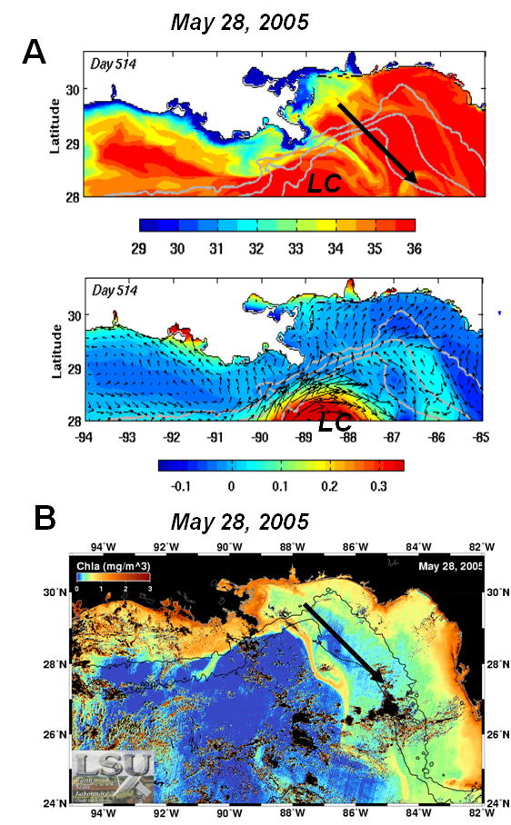
(A):Snapshot of model surface salinity and sea surface height + surface velocity vectors on May 28th, 2005, when the Loop Current System (LC) interacted with the Mississippi River plume. (B)Oceansat-1 OCM chlorophyll aimages on the same day. The chlorophyll ascale ranges from 0 to 3 mg m-3. River water is depicted in red/brown tones near the mouth of rivers, where pigment concentrations are highest and orange/yellow tones in deep water, where pigment concentrations are reduced.
The satellite image demonstrate the remarkable impact of the LC system over the transport of the MR plume. A distinct chlorophyll a band extending into the GoM, which agrees with the LC conditions during this period. The model surface salinity on the same day shows the presence of the low-salinity band just to the east of the delta, in agreement with the position of the chlorophyll a band across the shelfbreak. The satisfactory comparison reinforces the necessity to employ a modeling approach that uses lateral boundary conditions from a realistic, data-assimilative ocean model, in order to capture strong interactions between the MR plume and the Loop Current.